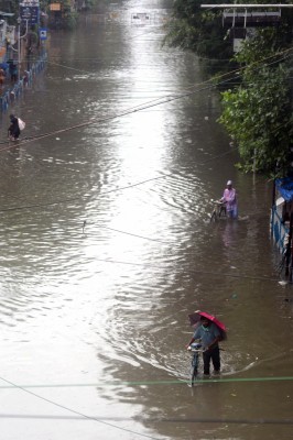
New Delhi,There were extreme floods in at least three districts of Kerala, heavy to very heavy rainfall in eastern states, and moderate to heavy rainfall in several states of northwest India on Sunday with the India Meteorological Department (IMD) predicting continuation of rainfall for next 3-4 days at least.
However, as per the IMD, there would be some relief even when rains would continue, especially for Kerala, over next 3-4 days.
The low pressure area over southeast Arabian Sea and adjoining Kerala on Saturday become less marked and now seen as a trough from south interior Karnataka till south Tamil Nadu at lower levels. "Under its influence, while isolated heavy rainfall is very likely over coastal Karnataka, Kerala, Mahe, Tamil Nadu, and Pudducherry on Sunday, there would be significant reduction in rainfall activity," the IMD said in its bulletin on Sunday.
"Thereafter, a fresh spell is likely to affect south Peninsular India from October 20 and cause fairly widespread rainfall with isolated heavy falls likely over Kerala, south interior Karnataka, Tamil Nadu, Pudducherry, Mahe, and Karaikal and likely to continue for subsequent 3-4 days," it said.
IMD Director General Mrutyunjay Mahapatra said that there were two low-pressure systems, one over the Bay of Bengal and another over the Arabian Sea, and there was some kind of interaction between these two.
"While the Bay of Bengal low pressure system moved west-north-westwards across north coastal Andhra Pradesh and adjoining south Odisha coast, the Arabian Sea system moved east-south-eastwards. And finally, the Bay of Bengal's low pressure system moved towards Telangana and the Arabian Sea system reached Kerala coast on Saturday. As a result, there was maximum rainfall activity over Kerala under the influence of this low pressure system."
This low-pressure system led to strengthening of southwest monsoon westerly winds near Kerala coast and the strong south-westerly winds interacted with the ghat areas, resulting in heavy to extremely heavy rainfall activity over different parts of Kerala. Idukki, Kolam and Ernakulam experienced high amount of rainfall exceeding 20 cms, he said.
For Delhi-NCR and other northwest India, the IMD said a western disturbance lies over Afghanistan and neighborhood and is interacting with easterlies at lower levels from the Bay of Bengal. "It is very likely to continue during next 2-3 days. Under their influence, fairly widespread to widespread light to moderate rainfall with heavy to very heavy rainfall at isolated places is very likely over Uttarakhand and west Uttar Pradesh till October 19, over Himachal Pradesh, Haryana and Chandigarh and east Uttar Pradesh on Monday. Isolated extremely heavy falls are also likely over Uttarakhand and west Uttar Pradesh on Monday."
In eastern India, due to strong easterly winds from the Bay of Bengal, a heavy spell of rainfall activity is very likely to continue till October 20 with fairly widespread to widespread light to moderate rainfall with heavy rainfall at isolated places very likely over Odisha on Monday, over Gangetic West Bengal till October 20, over sub-Himalayan West Bengal and Sikkim during from Monday till October 20, over Jharkhand on Monday and Tuesday, and Bihar on Tuesday.
Isolated very heavy falls are also very likely over Gangetic West Bengal on Monday and over sub-Himalayan West Bengal and Sikkim on October 19 and 20, the IMD said.
Further, due to strong southerly/southeasterly from the Bay of Bengal over northeast India during October 18-21, fairly widespread to widespread light to moderate rainfall with heavy rainfall is expected at Nagaland, Manipur, Mizoram, and Tripura.


.jpeg)

